Town guide
Things to Do in Saint-Malo (and a Side Trip to Cancale)
Quick answer
Walk the 1.75 km (1.1 miles) of ramparts, wander the walled town rebuilt after 1944, and cross to Grand Bé at low tide to see Chateaubriand's grave. Add the Fort National, the Sillon beach and the Mémorial 39-45. Cancale's oyster market is 19 km (12 miles) away and open every day of the year.
| Fact | Detail |
|---|---|
| Ramparts | 1,754 m (about 1.1 miles) around the walled town, restored intact after 1944 |
| Grand Bé | On foot at low tide only; the city publishes safe crossing times month by month |
| From Paris by train | From Paris Montparnasse, 2 h 29 on the fastest train, from $30 / €27 one way |
| Cancale | 19 km (12 miles), about 25 min by car; oyster market open every day of the year |
| Mont-Saint-Michel | 55 km (34 miles), about 50 min by car or 1 h by Keolis coach |
| Base for the Mount | 18% of the Mount's day visitors who sleep away from home stay in the Saint-Malo area (Flux Vision 2025) |
Saint-Malo is a walled port town on the north coast of Brittany, about 50 minutes from Mont-Saint-Michel, and the best things to do here are free and outdoors: walk the ramparts, get lost in the walled town, and time your day to the tide so you can cross to Grand Bé. The tides here are part of the plan, not a footnote. They decide when you can reach the islands, which beach you get, and how long you can stay out there.
It's also where a lot of Mont-Saint-Michel visitors sleep. In 2025, the Saint-Malo area came first among people who visited the Mount for the day while sleeping away from home (18%, according to Flux Vision). This page is the town itself. If you're here mainly for the Mount, my guide from Saint-Malo to Mont-Saint-Michel covers the bus, tours and driving.
Walk the ramparts
The ramparts are the first thing to do in Saint-Malo, and the easiest. They run 1,754 m (about 1.1 miles) around the walled town, and they came through 1944 intact enough to be restored, according to the tourist office. They were built in two main periods: the medieval enclosure, worked on until the end of the 17th century, and the additions of 1708 to 1744.
From the top you get the whole picture in one loop: the harbor on one side; on the other, the beaches, the Fort National on its rock and the two Bé islands offshore. Between the Saint-Philippe and Saint-Louis bastions, the walk passes the row of tall granite houses built by 18th-century shipowners and merchants. Most of those facades were rebuilt identically after the war.
Go once at low tide and once at high tide if you can. It's the same walk, but the view changes completely.

Walk the ramparts in the evening, with the tide coming in against the wooden breakwaters and the island forts catching the last of the sun.
Intra-Muros: the walled town and its rebuilding
Inside the walls, Intra-Muros is a grid of narrow granite streets, and almost all of it is a reconstruction. The fighting of 1944 destroyed about 80% of the walled town, according to the tourist office, and Saint-Malo was rebuilt on the preserved ruins in a way that follows its old look.
The landmarks the tourist office points you to:
- The castle, at the entrance to the walled town, with four corner towers around a 35 m keep. It's the town hall today. The Quic-en-Groigne tower was built on the orders of Anne of Brittany, over the objections of the people of Saint-Malo.
- Saint-Vincent Cathedral, a cathedral since 1146 and built over nearly seven centuries. It was badly damaged in 1944 and restored over many years, with modern stained glass and the tombs of the explorer Jacques Cartier and the privateer Duguay-Trouin.
- The Duchess Anne's House, a 15th-century mansion, and the Saint-Sauveur chapel (1743), which now hosts the big summer exhibitions.
The walled town is small, so the pleasure is in taking the long way round.
Grand Bé and Fort National at low tide
Two islands sit just off the walls, and both are on foot at low tide only. Get the tide times before you go.
Grand Bé. A stone causeway runs from Bon-Secours beach to the islet. The writer François-René de Chateaubriand (1768-1848), born in Saint-Malo, asked to be buried here, near the cliff and facing the sea. His tomb and the whole islet have been a listed historic monument since November 24, 1954.
The City of Saint-Malo publishes safe crossing times for Grand Bé month by month on its tides page, and it has put up signs with a QR code around Bon-Secours beach that link to them. It also warns that walkers are regularly caught by the rising tide on the way back, that the water rises fast and that the currents can be strong. If the window is short, go another day.
Fort National. The fort was built in 1689 by the engineer Siméon Garengeau, to Vauban's plans and on Louis XIV's orders, to defend the town. You reach it at low tide from the main beach, the Plage de l'Éventail, in front of the castle. Visits are guided only and take about 35 minutes. Adults pay €5 (about $6) and children aged 6 to 16 pay €3 (about $3).
It doesn't open all year: the fort lists the Easter and All Saints' school holidays, long weekends in spring, and every day from June 1 to September 30. Opening hours follow the tides, so they change daily. When the French flag is up on the mast, the fort is open.
Beaches: Sillon and Bon-Secours
Plage du Sillon. Saint-Malo's biggest sandy beach is 3 km (almost 2 miles) long, running from the walled town to Paramé. It's really three beaches in a row, the Grande Plage, the Hoguette and Rochebonne, backed by the Digue, a seafront promenade built between 1883 and 1913 on the old sand spit that gave the beach its name.

Bon-Secours. The small beach right under the ramparts is the one in the postcards. It has a seawater swimming pool with a diving board, and a sailing school. It's also where you start the walk to Grand Bé, with Petit Bé behind it.
Saint-Malo in World War II
For American visitors this is the part of Saint-Malo's story that connects with Normandy. In August 1944, the walled town was a German stronghold, and American troops laid siege to it.

The Fort National's own account describes what happened to the town's men. On August 6, 1944, Saint-Malo was shelled and the cathedral's spire fell. The next morning, the German command marched 380 men of Saint-Malo to the Fort National and held them there. On the night of August 9 to 10, Allied shells hit the fort and killed 18 of them; their names are engraved where they died. Over the following days the hostages watched the town burn.
The German garrison held out in the old fort of the Cité d'Aleth, in Saint-Servan. According to the Brittany regional heritage inventory, it was shelled from August 9 and repulsed two assaults, on August 11 and 15, before its commander, Colonel Andreas von Aulock, surrendered on August 17, 1944.
The bunkers the Germans built in that fort now house the Mémorial 39-45, open since 1994. It holds more than 1,500 objects, and visits are guided only and last about an hour. The tourist office lists adult tickets from €7 to €10.50 (about $8 to $12), but its listing doesn't confirm current opening hours, so check before you go.
If this history is why you came, Bayeux and the D-Day beaches are 169 km (105 miles) east, about 2 hours 10 minutes by car. My guide to the D-Day beaches covers them.
Cancale: oysters and the bay
Cancale is the side trip from Saint-Malo, and you go for the oysters. It's 19 km (12 miles) east, about 25 minutes by car, on the shore of the Bay of Mont-Saint-Michel.
The oyster market. At the far end of the Port de la Houle, under the lighthouse and facing the oyster beds, oyster farmers sell hollow and flat oysters from their stalls. You can take them away or eat them right there. The tourist office says the market is open every day of the year, from morning to evening, and its listing shows 9 a.m. to 7 p.m., though it flags those hours as unconfirmed. The oyster beds run in a grid along the coast from the Rocher de Cancale south toward Saint-Benoît-des-Ondes, and at low tide you can watch the farmers working them.
The port and the back streets. La Houle was the fishermen's quarter in the 18th and 19th centuries, and the narrow streets behind the quay are still mostly their modest houses. On the quay, a bronze fountain by the sculptor Jean Fréour (2000) honors the women who sorted and washed the oysters. The bisquine La Cancalaise, a replica of a 1905 local fishing boat, takes people sailing.
The Pointe du Grouin. About 4.7 km (3 miles) north of the harbor by road, this rocky headland is the most advanced point of the Ille-et-Vilaine coast. On a clear day you see Cap Fréhel on one side and Mont-Saint-Michel, 25 km away, on the other, with the Chausey islands out to sea. The GR34 coastal path runs 7 km (4.3 miles) to it from the Pointe des Crolles, near the port, if you want to walk.

Getting there without a car takes some planning, and the Keolis coach to Mont-Saint-Michel doesn't stop in Cancale. The ways to combine Cancale with the Mount are in my guide from Saint-Malo to Mont-Saint-Michel.
Day trips from Saint-Malo
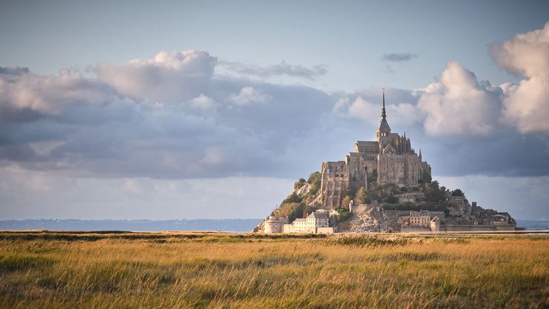
Mont-Saint-Michel. It's 55 km (34 miles), about 50 minutes by car, and the Keolis Armor coach does it in about an hour from the Esplanade Saint-Vincent. Timetables, fares, tours and parking are on my Saint-Malo to Mont-Saint-Michel page, and what to do once you're there is on my Mont-Saint-Michel guide. Check the tide calendar when you choose the day.

If you'd rather be driven and guided, Tour Travel & More runs a 5-hour private tour that picks up at Saint-Malo hotels or the cruise port, with about 3 hours at the Mount and the abbey ticket included. It was listed from $617 / €550 per person on Viator on November 15, 2026, with a minimum of two people and a price that drops as the group grows.
Check dates for the private Mont-Saint-Michel tour on Viatorvia Viator
Dinard. Across the Rance estuary, Dinard is 10 minutes away by boat. Compagnie Corsaire's sea bus costs €8.90 (about $10) return for an adult outside the peak season, and you get a view of the ramparts from the water on the way back.
Dinan. The medieval town on the Rance is 33 km (20 miles) south, about 35 minutes by car. A full guide to Dinan is on my list.
Two days from Paris. If you're starting in Paris and don't want to drive, Extime Travel runs a 2-day coach tour that covers the D-Day beaches, Saint-Malo and Mont-Saint-Michel, with a night in a 4-star hotel. Prices are per person, as listed on November 15, 2026:
| Platform | From | Rating | Book |
|---|---|---|---|
| GetYourGuide | $560 / €499 | 4.5 (111 reviews) | Check datesvia GetYourGuide |
| TourRadar (Black Friday offer, twin room) | $475 / €424 | 4.8 (5 reviews) | Check datesvia TourRadar |
The TourRadar price was a time-limited deal when I checked, so compare both on the day you book.
Where to stay in Saint-Malo
For the walled town at night, sleep Intra-Muros. For more space and the beach, look along the Sillon. I compare Saint-Malo hotels with the island and La Caserne, with prices for a June 2027 night, in my guide to Mont-Saint-Michel hotels.

Getting to Saint-Malo
By train from Paris. Trains leave from Paris Montparnasse. SNCF Connect listed 14 a day in mid-November 2026, some direct and some with a change in Rennes, with the fastest at 2 hours 29 minutes and fares from $30 / €27 one way on a few trains. Book early, since most tickets cost more. My Paris to Normandy guide covers the other ways out of Paris.
By car. The tourist office puts Paris to Saint-Malo at about 4 hours, 403 km (250 miles) by the A13 and A84 or 417 km (259 miles) by the A11. If you're leaving Paris on the A13 between November 16, 2026 and August 31, 2027, note that the Saint-Cloud tunnel is closed toward Normandy.
By ferry from the UK. Brittany Ferries sails between Portsmouth and Saint-Malo, with an average crossing of 8 hours 45 minutes. There are also direct boats to Jersey and Guernsey.
How I put this page together
I've been to Normandy and Mont-Saint-Michel several times. The ramparts, the walled town, the beaches and Cancale come from the Saint-Malo tourist office; Grand Bé safety and tide times from the City of Saint-Malo; the Fort National's history, hours and prices from the fort's own site; the 1944 siege from the fort and from the Brittany regional heritage inventory. Train figures are from SNCF Connect, ferry times from Brittany Ferries and driving distances from OpenStreetMap routing. Tour prices and ratings are the platforms' figures on November 15, 2026, not my ratings, and I haven't taken these tours.
Dollar prices use the Banque de France rate of November 10, 2026 ($1.1214 per euro), rounded. Tide times change every day, so check them on the city's site before you head out to the islands.
More of Saint-Malo from my visits
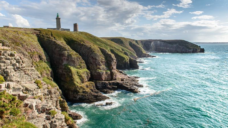
Cap Fréhel, the headland you see from the Pointe du Grouin on a clear day, Cap Fréhel 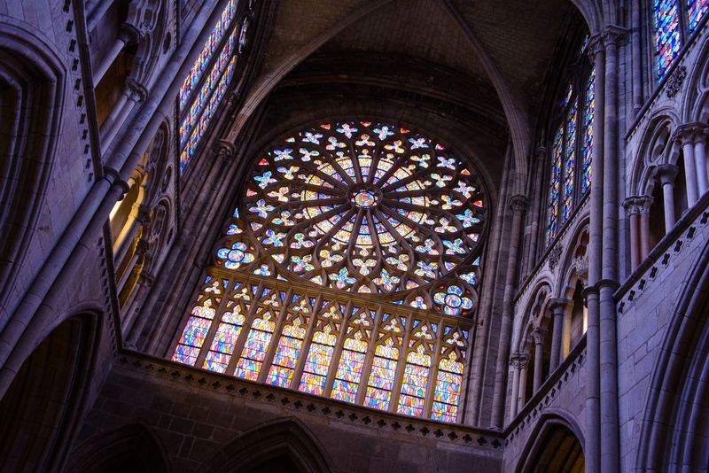
Saint-Malo 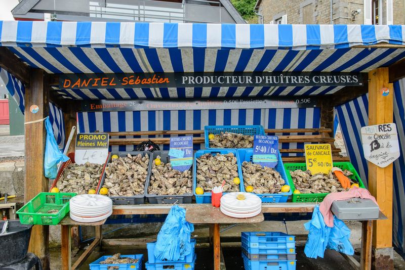
Cancale 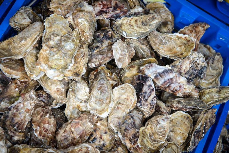
Cancale 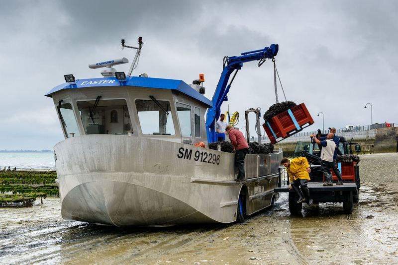
Cancale


Frequently asked questions
How long do you need in Saint-Malo?
One full day covers the ramparts, the walled town, Grand Bé at low tide and a beach. Give it two days if you want the Fort National, the Mémorial 39-45 and a half day in Cancale. Most of what you'll want to see is inside or right next to the walls, so you don't need a car in town.
Can you walk to Grand Bé?
Yes, but only at low tide, along a stone causeway from Bon-Secours beach. The City of Saint-Malo publishes safe crossing times for each month on its tides page, and it warns that the water comes back fast with strong currents. Walkers get cut off on the way back often enough that the fire service has asked the city to step up its warnings.
Is Cancale worth a stop?
Yes, if you like oysters or coastal walks. The oyster market at the Port de la Houle is open every day of the year, and the farmers sell straight from their stalls facing the oyster beds. The Pointe du Grouin, 4.7 km (3 miles) north of the harbor, looks out over the bay to Mont-Saint-Michel, 25 km away.
Is Saint-Malo a good base for Mont-Saint-Michel?
It's the most popular one. In 2025, 18% of the Mount's day visitors who were sleeping away from home slept in the Saint-Malo area, according to Flux Vision. The Mount is 55 km (34 miles) away, about 50 minutes by car or an hour on the Keolis coach. You give up the Mount at night, but you get the walled town, the beaches and Cancale.
Sources (26)
- Saint-Malo Tourisme: must-sees in the Corsair City (ramparts, castle, cathedral, Bon-Secours)
- Saint-Malo Tourisme: Intra-Muros walking tour brochure (80% destroyed in 1944)
- Ville de Saint-Malo: tides and safe access times to Grand Bé
- Ville de Saint-Malo: Grand Bé access, safety warning
- Saint-Malo Tourisme: writers of the destination (Chateaubriand's grave on Grand Bé)
- Ministère de la Culture, base Mérimée: Chateaubriand's tomb and the Grand Bé islet (PA00090870)
- Fort National: visit, prices and opening (tide dependent)
- Fort National: history of the fort
- Fort National: the hostages of August 1944
- Région Bretagne, Inventaire du patrimoine: Fort de la Cité d'Aleth, now the Mémorial 39-45
- Saint-Malo Tourisme: Mémorial 39-45 (guided tours, rates)
- Saint-Malo Tourisme: Plage du Sillon
- Saint-Malo Tourisme: Cancale and the Port de la Houle
- Saint-Malo Tourisme: Cancale oyster market (listing and hours)
- Saint-Malo Tourisme: from the Pointe du Grouin to Radegonde Bay
- Saint-Malo Tourisme: how to get here (train, bus, ferries, road)
- Compagnie Corsaire: Saint-Malo to Dinard sea bus (times and fares)
- Brittany Ferries: routes and average crossing times
- SNCF Connect: Paris to Saint-Malo trains
- Manche tourism observatory: Flux Vision 2025, Mont-Saint-Michel-Normandie
- Viator: Tour Travel & More, 5-hour private tour of Mont-Saint-Michel from Saint-Malo hotel or port
- GetYourGuide: Extime Travel, From Paris: 2-Day Normandy & Brittany Tour
- TourRadar: Extime Travel, D-Day Beaches, Saint-Malo & Mont Saint-Michel 2-day journey from Paris
- Booking.com: Saint-Malo hotels
- OSRM (OpenStreetMap routing): driving distances from Saint-Malo
- Banque de France: EUR/USD reference rate, November 10, 2026
Keep planning
Related guides