Tide guide
Mont-Saint-Michel Tides: When to See the Island Surrounded by the Sea
Quick answer
Mont-Saint-Michel is only cut off by the sea on the biggest spring tides, for about an hour around high water. Normandie Tourisme puts the threshold at a coefficient above 110, and from January to November 2026 the highest was 105. Arrive one to two hours before high tide, and never walk the bay without a guide.
| Fact | Detail |
|---|---|
| Tidal range | Up to 15 m (49 ft) between low and high tide |
| Island tides | Coefficient above 110 (Normandie Tourisme); cut off about 1 hour |
| When to arrive | 1 to 2 hours before high tide |
| Stuck on the Mount | 1 to 1.5 hours before you can walk back |
| Highest tide in 2026 | Coefficient 105, April 18, 8:54 p.m. (Jan-Nov, Saint-Malo time) |
| 2027 official table | Not published yet (checked Nov 15, 2026) |
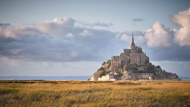
The bay of Mont-Saint-Michel has the biggest tides in continental Europe, and they're the reason the Mount is on so many postcards surrounded by water. In real life that only happens on a few days a year, for about an hour each time. Most visitors see the rock standing in sand.
On a big tide, watch from the ramparts rather than the sand: in a short time the flats you could have walked across become sea all around the Mount.
This page explains how to tell which days are the big ones, where to stand, and what changes on the day. Every figure comes from the tourist office, the Établissement public du Mont-Saint-Michel (the state body that runs the site), Normandie Tourisme or SHOM, France's official tide service, checked on November 15, 2026.

How the tides work at Mont-Saint-Michel
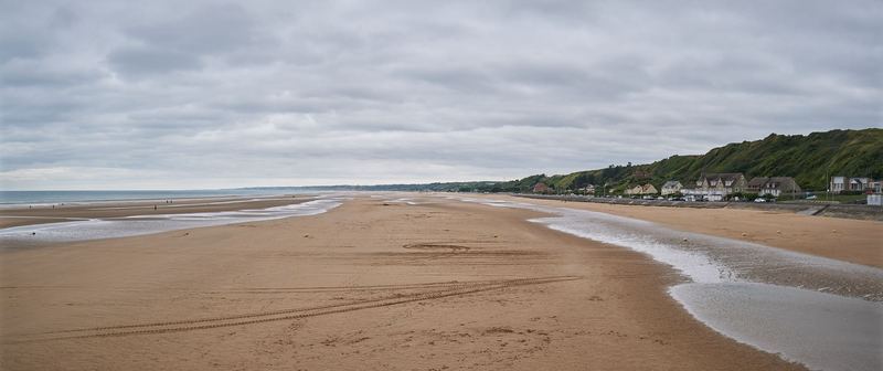
The difference between low and high tide in the bay reaches 15 meters (49 feet), according to the tourist office, and at low tide the sea pulls back as far as 15 km (9 miles) from the coast. When it returns, it moves at around 6 km/h (about 3.7 mph), says Normandie Tourisme. That's walking pace, but on flat sand with channels filling behind you, it's fast enough to cut people off.
Two things decide how high a given tide climbs:
- The moon and the sun. When they line up with the Earth, at full and new moon, you get spring tides. The tourist office says the strongest arrive 36 to 48 hours after the full or new moon.
- The season. The biggest spring tides of the year come around the March and September equinoxes.
The Mount sits at the edge of the bay, so on neap tides the sea doesn't reach it at all. During spring tides, which come about every two weeks, the water reaches the rock about 4 hours 30 minutes after it starts rising, according to the tourist office.
What the tidal coefficient means
French tide tables give each high tide a coefficient. SHOM calculates it for the port of Brest and uses it for the whole French Channel and Atlantic coast. It runs from 20 (the smallest neap tide) to 120 (the biggest possible spring tide), and 100 corresponds to an average spring tide near the equinoxes.
At Mont-Saint-Michel, the number that matters is the top of that scale.
When does the Mount become an island?
Normandie Tourisme gives the clearest rule: above a coefficient of 110, the Mount becomes an island again for a few hours. The Établissement public describes it on the footbridge page as about an hour, during the big tides, when water covers the end of the approach.
Below 110 you'll still see water around the base on a strong tide. In August 2026, the Établissement public published advice for tides of 100 to 102 and described visitors coming to watch the Mount become an island. So treat 100 as "worth a look" and 110 as the real thing.
How rare is 110? In the official 2026 table, January to November, no tide reached it. The highest was 105, on the evening of April 18. Coefficients change from one year to the next, which is why the official table for your year is the only safe guide.
2027 high tide calendar
The official 2027 table wasn't published when I checked on November 15, 2026. The tourist office had 2025 and 2026 online, and the Établissement public's downloadable calendar was the 2026 edition. I'll add the 2027 dates here once the tourist office puts them out.
Until then, here's how to check a date yourself:
- Tourist office tide schedules (ot-montsaintmichel.com). Month by month, with morning and evening high tides and their coefficients. The times are SHOM predictions for Saint-Malo; add about 5 minutes for the Mount.
- Établissement public, weather and tides page (montsaintmichel.gouv.fr). Today's high tides, heights and coefficients, plus the dam release times and a downloadable yearly calendar.
- SHOM's free tide service (maree.shom.fr). Pick Saint-Malo for times and coefficients straight from the source.
To show you what a year looks like, these were all the tides with a coefficient of 100 or more from January to November 2026, from the tourist office table:
| Date (2026) | Morning high tide | Evening high tide |
|---|---|---|
| March 19 | 7:46 p.m. (101) | |
| March 20 | 8:03 a.m. (103) | 8:21 p.m. (104) |
| March 21 | 8:39 a.m. (104) | 8:56 p.m. (103) |
| March 22 | 9:14 a.m. (100) | |
| April 17 | 8:15 p.m. (101) | |
| April 18 | 8:35 a.m. (104) | 8:54 p.m. (105) |
| April 19 | 9:15 a.m. (104) | 9:32 p.m. (102) |
| August 13 | 8:46 p.m. (100) | |
| August 14 | 9:15 a.m. (102) | 9:28 p.m. (102) |
| August 15 | 9:54 a.m. (101) | |
| September 11 | 8:25 p.m. (101) | |
| September 12 | 8:49 a.m. (102) | 9:02 p.m. (101) |
| September 13 | 9:24 a.m. (100) | |
| October 27 | 7:47 p.m. (100) |
Saint-Malo times; coefficient in brackets. A blank cell means that tide was under 100.
Two patterns stand out. The big tides came in clusters of three or four days, around the equinoxes and in late summer. And every one of them peaked between about 7:45 and 10 o'clock, morning or evening. That's the opposite of when day-trip coaches are on the Mount, which is worth knowing if you're coming on a day trip from Paris.
Where to watch the tide come in
Get there early. The Établissement public advises arriving one to two hours before high water, to see the tidal bore and to reach the Mount before the water surrounds it. Normandie Tourisme says two hours.

On or near the Mount, the official suggestions are:
- The footbridge, where the rivers meet the bay.
- The ramparts and the west terrace of the abbey. The terrace is inside the abbey, so you need a ticket and it has to fall within opening hours.
Around the bay, the tourist office lists the spots where the tidal bore (a wave that runs up the river mouths on the rising tide) is easiest to see, with how early to arrive:
| Viewpoint | Arrive before high tide |
|---|---|
| Grouin du Sud, Saint-Léonard (Vains) | 1 h 30 |
| Roche Torin, Courtils | 1 h 15 |
| Le Rivage, Vains | 45 min |
| Gué de l'Épine, Val-Saint-Père | 45 min |
| Marcey-les-Grèves bridge | 30 min |
| Pontaubault bridge | 30 min |
| Mont-Saint-Michel | 2 h |
Wind and air pressure can shift both the time and the height of a tide, the tourist office warns, so treat the table times as approximate.
What changes on a high-tide day
The footbridge, 2.2 km long, gives access to the Mount all year, except during the big tides, when the Établissement public says the Mount becomes an island for about an hour. If you're on the rock when that happens, you stay. Plan on 1 to 1.5 hours before you can walk back to the footbridge.

A few other things to know:
- The bike racks inside the walls (70 spaces at the fanils) can go under water on strong tides, the Établissement public warns.
- The Couesnon dam releases water about six hours after high water. The current builds over 20 minutes, the river rises about 40 cm in the bay, and a release can last two to five hours, says the tourist office. Release times for today and tomorrow are on the Établissement public's site and on a sign at La Caserne, by the road to the Mount.
- Evening tides need a light. Some big tides fall after dark (several in August 2026 did), and the Établissement public recommends bringing a working flashlight.
- Crowds. Big-tide days draw extra visitors on their own; in August they add to the summer peak.
Walking the bay: only with a guide
Walking on the sand is a big part of why people come, and it's the part that goes wrong. The tourist office calls it extremely dangerous to venture alone into the bay, including right around the Mount. The Établissement public's list of rules is specific:

- don't go out alone, and prefer a crossing with a professional guide;
- check the tide times and plan your return, without waiting for high water;
- don't cross streams or areas the tide has already covered;
- stay away from quicksand and ground you don't know;
- cancel in fog, storms or bad weather;
- call 112 in an emergency.
It also asks visitors to keep at least 300 meters from wild animals, keep dogs on a leash and not fly drones.
The tourist office lists 43 bay guides certified by the prefecture. They run walks all year: about 1.5 to 2 hours to discover the quicksand, 3 to 3.5 hours to Tombelaine islet, or the 13 km round trip from Genêts or the Grouin du Sud to the Mount, the old pilgrim route.
One of the listed guides, Stéphane Gueno, sells a 3-hour bay walk on Viator from $18 / €16 as of November 2026, rated 4.8 from 230 reviews (the platform's figures, not mine).
Check dates for the guided bay walkvia Viator
A bay walk and watching the Mount get cut off are two different outings. If you want both on the same day, ask the guide how the walk fits around that day's high tide.
Best time of year and day to visit
If seeing the water around the Mount matters to you, pick the date by the tide first:
- Month: in 2026 the big tides came in March, April, August, September and October. March, April, September and October are also mid-season, outside the July-August peak, which the Cour des comptes says brought 35.6% of the year's visitors in 2023.
- Time of day: in 2026, every 100-plus tide peaked around 8 to 10 in the morning or the evening. A morning tide means sleeping nearby; an evening one means staying late.
- Moon: if the official table isn't out yet for your dates, look for the two days after a full or new moon near an equinox, then confirm with the table.
For tickets, parking and crowds through the year, see my guide to visiting Mont-Saint-Michel.
Staying overnight for the evening tide
Because the big tides fall early or late, the visitors who see them are mostly the ones who sleep nearby. The car parks are free from 6:30 p.m. to 3 a.m. from September to June, and the free shuttle runs until 11 p.m. in spring and autumn, so an evening tide is easy if your bed is close. My guide on how to stay overnight near the Mount compares the island, La Caserne and the nearby towns.
See hotels near Mont-Saint-Michelvia Booking.com
Coming from further away? The Mount works from Bayeux or from Saint-Malo, but with an evening tide you'll be driving back after dark.
Frequently asked questions
When is high tide at Mont-Saint-Michel?
Twice a day, and about 40 minutes later from one day to the next, so the time shifts all the time. The tourist office publishes the year's times using SHOM predictions for Saint-Malo; add about 5 minutes for the Mount. In 2026, every tide with a coefficient of 100 or more peaked between about 7:45 and 10 o'clock, morning or evening.
Is Mont-Saint-Michel an island at high tide every day?
No. On neap tides the sea doesn't reach the rock at all. Only on the biggest spring tides does water cover the approach and cut off the Mount, and then for about an hour, according to the Établissement public du Mont-Saint-Michel. The rest of the time you can walk across the footbridge at any hour.
What tidal coefficient do you need to see it surrounded by water?
Normandie Tourisme says above 110. The coefficient runs from 20 to 120, and 100 is an average equinoctial spring tide. The Établissement public also promoted tides of 100 to 102 in August 2026 as island tides, so expect some water from 100 and the full effect only at the top of the scale.
Can you walk to Mont-Saint-Michel at low tide?
You can always reach it by the 2.2 km footbridge. Walking across the sand is another matter: the official advice is never to go into the bay alone, even close to the Mount, because of quicksand and a tide that can come in fast. Go with one of the guides certified by the prefecture.
Is it dangerous to walk in the bay?
Yes, without a guide. The sea goes out up to 15 km and comes back at around 6 km/h, according to Normandie Tourisme, and the Établissement public warns it can start rising suddenly two hours before high water. Fog makes it worse. With a certified guide, bay walks run all year.
What is the best month to see the high tides?
The biggest tides come around the spring and autumn equinoxes. In 2026, the tides of 100 or more fell in March, April, August, September and October, with the peak on April 18. The 2027 table wasn't out when I checked, so confirm your date on the official tide table before you book.
Sources (11)
- Mont-Saint-Michel tourist office: tide schedules (SHOM predictions for Saint-Malo)
- Mont-Saint-Michel tourist office: the high tides and the tidal bore
- Mont-Saint-Michel tourist office: certified bay crossing guides
- Normandie Tourisme: high tides at Mont-Saint-Michel
- Établissement public du Mont-Saint-Michel: weather, tides and dam releases
- Établissement public du Mont-Saint-Michel: high tide safety advice (August 6, 2026)
- Établissement public du Mont-Saint-Michel: getting there on foot (footbridge)
- SHOM (French Navy hydrographic service): free tide times
- SHOM Refmar: tide prediction fact sheet (tidal coefficient)
- Cour des comptes: L'établissement public du Mont Saint-Michel, 2020 onwards (July 2025)
- European Central Bank: EUR/USD reference rate, November 10, 2026
Keep planning
Related guides